
... implying the Raelian version of history as being true."Isn't it time we rewrote our history books?"
The clip showcases a 16th-century map produced by Turkish admiral Piri Reis. It is claimed that the map depicts an outline of Antarctica without its ice caps and that it was drawn 300 years before the modern discovery of that continent.
Bad Archaeology's Keith Fitzpatrick-Matthews points out:
Maps of the fifteenth to eighteenth centuries are a favourite source of information for fringe writers, who use them to make a wide variety of claims. To Erich von Däniken, for instance, they are evidence for a survey of the Earth from space, carried out by extraterrestrials, while for Graham Hancock, they are evidence for an ancient sea-faring civilisation, lost beneath the sea after the melting of glacial ice at the end of the Pleistocene. These writers focus on a relatively small number of such maps, those of Piri Re‘is and Orontius Finaeus being the most used, whilst ignoring others of the same age. All these maps are alleged to show anomalous knowledge for the dates at which they were drawn: the west coast of South America, Antarctica (with or, more frequently, without its ice sheet), the Strait of Magellan and other “impossible” details. This appears to be solid evidence, so why do mainstream historians and archaeologists ignore it?Fitzparick-Matthews' article traces the origins of this claim, originating not from scholarly studies of the map, but from a geography college teacher by the name of Charles Hapgood (1904-1982). He shows where and how Hapgood got it wrong and that the map in fact did not show Antarctica at all, but the coastline of South America only instead.
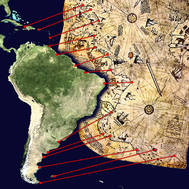
The following map shows which points of the South American coastline corresponds to the points on Piri Reis' map:
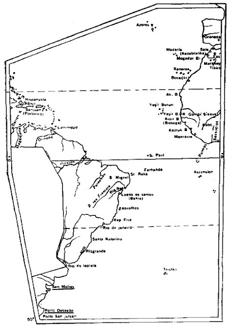

The following shows Piri Re‘s’s map as replotted by Ayşe Afet İnan, showing placenames that identify places in Argentina:

It should be noted, however, that this specific claim does not appear in Rael's original writings. It is based on the inference that ETs have surveyed the Earth at a time when humans were too primitive and therefore ignorant to acquire such secret knowledge unless given to them by the former.
The irony here is, Rael has already rewritten our history by reinterpreting the Bible in light of fringe pseudoscientific beliefs of ancient astronauts. LOL
No comments:
Post a Comment